Sign up to unlock all our services and 1230 corrected and explained questions.
Question 23-1 : What is the approximate speed of a 5 ms wind expressed in kt ? [ Support weather ]
10 kt
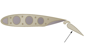
Question 23-2 : Indicate what would be in a wind of 6 knots the position of a wind indicator on an aerodrome ?
30 degrees below the horizon.
Img41wind indicator angle based on wind speed 42Completely vertical. 5 degrees below the horizon. 60 degrees below the horizon.
Question 23-3 : Indicate what would be in a wind of 10 knots the position of a wind indicator on an aerodrome ?
5 degrees below the horizon.
Img40wind indicator angle based on wind speed 4230 degrees below the horizon. completely vertical. 60 degrees below the horizon.
Question 23-4 : Indicate what would be in a wind of 15 knots or above the position of a wind indicator on an aerodrome ?
Completely horizontal.
Img40wind indicator angle based on wind speed 42Completely vertical. 30 degrees below the horizon. 60 degrees below the horizon.
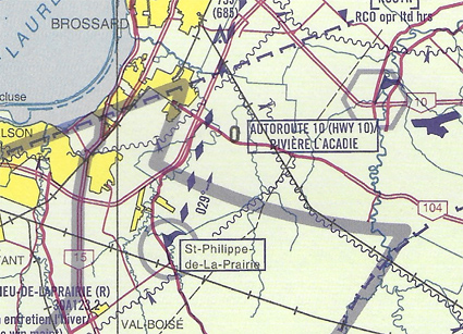
Question 23-5 : According to the annex the location 'autoroute 10 hwy 10 riviere l'acadie' is 43 ?
A vfr check point.
A vfr call up point. an aerodrome without hard surfaced runway. an aerodrome with hard surfaced runway.
Question 23-6 : According to the annex the location st philippe de la prairie is 43 ?
A vfr call up point.
A vfr check point. an aerodrome without hard surfaced runway. an aerodrome with hard surfaced runway.
Question 23-7 : According to the annex the location church fall is 45 ?
A vfr check point.
A ruin. a vfr call up point. a waterfall.
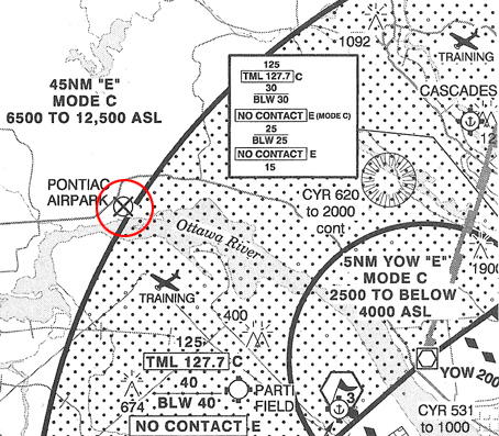
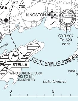
Question 23-8 : According to the map extract shown on the screen messier aerodrome is 46 ?
A land restricted aerodrome.
A land aerodrome. a water aerodrome. the presence of an abandoned aerodrome.
Question 23-9 : According to the map extract shown on the screen the aerodrome located in the red circle indicates the presence of 47 ?
An abandoned aerodrome.
A water aerodrome. an uncontrolled aerodrome. a controlled aerodrome.
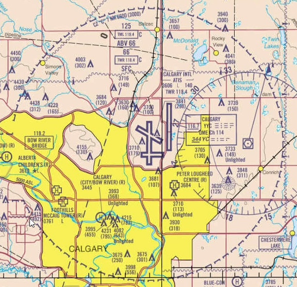
Question 23-10 : According to the map extract shown on the screen the circle with a u inside indicates 46 ?
The presence of aerodrome of which the status is unknown.
Question 23-11 : According to the vnc map extract shown on the screen the direction and the distance between three hills aerodrome and drumheller aerodrome are 48 ?
Southeast 21 nm.
Question 23-12 : Time and longitudeduring radiocommunications to express time the following clock system should be used ?
Twenty four hour clock system.
Question 23-13 : Time and longitudeduring summer difference between utc and pacific standard time pst is 7h when it is 11h utc pst is ?
4h pst.
18h pst. 11h pst. 7h pst.
Question 23-14 : Time and longitudethe primary time scale used for aviation is ?
Coordinated universal time utc .
Standard time. local time. time zone.
Question 23-15 : Time and longitudedifference between utc and eastern standard time est is 5h at noon est utc time is ?
17h utc.
8h utc. 12h utc. 7h utc.
Exclusive rights reserved. Reproduction prohibited under penalty of prosecution.