Sign up to unlock all our services and 1230 corrected and explained questions.
Question 67-1 : Flight planning. you plan to operate your drone in the vicinity of an uncontrolled aerodrome, where can you find the appropriate frequencies ? [ Mandatory specific ]
In the book 'canada flight supplement cfs '.
Question 67-2 : To determine cruising altitude for direction of flight in northern domestic airspace nda , we used ?
Question 67-3 : To determine cruising altitude for direction of flight in southern domestic airspace sda , we used ?
Question 67-4 : To conduct operations at victoria harbour camel point bc heli , you must obtain permission from. 49 ?
Question 67-5 : Global navigation satellite system gnss/gps. what is the minimum number of gnss/gps satellites required to obtain an accurate 3d position fix ?
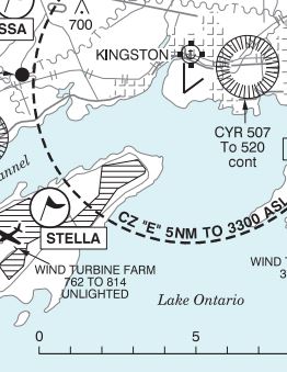
Question 67-6 : What class of airspace does the dashed circle around the ottawa international airport represent. 50 ?
Question 67-7 : What class of airspace does the dashed circle around the calgary international airport represent. 51 ?
Question 67-8 : What class of airspace does the dashed circle around the mont tremblant international airport represent. 52 ?
Question 67-9 : What is the magnetic variation at victoria habour camel point bc heli. 49 ?
Question 67-10 : Which satellite constellations are supported by unmanned aircraft systems ?
Question 67-11 : On navigational maps, the circles indicate by the arrows are. 53 ?
Question 67-12 : Global navigation satellite system gnss/gps. gps ?
Question 67-13 : Global navigation satellite system gnss/gps. the primary information provided by a gps is ?
Geographical position.
Question 67-14 : Global navigation satellite system gnss/gps...the optimal use of a gps receiver is disturbed by.1 the terrain elevation.2 cloud coverage.3 clock failure of one or more satellites.4 variations of speed of the remotely piloted aircraft.5 low flying height.6 absence of remote or external antenna ?
3 6.
Question 67-15 : Global navigation satellite system gnss/gps. 'way point' on a gps is used to ?
Find a position already inserted in the user's database.
~
Exclusive rights reserved. Reproduction prohibited under penalty of prosecution.
989 Free Training Exam

